Easy fun maps made from ArcGIS Online
A section for posting maps made from ArcGIS online that just require an esri account and adding layers to a map. There are lots to search for with links to their information.
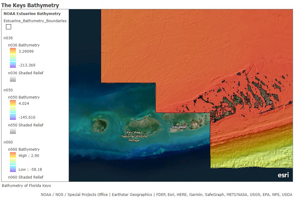
This is a map with an imagery basemap off the coast of south Florida covering the keys islands. I did some scuba diving there and there was alot of interesting wildlife and environment to see. The source of this layer is from the National Ocean Service Estuarine Bathmetry, a digital raster compilation of a hydrographic survey for different parts of the US focusing on preserving wetland resources. This layer is composed of 70 bathmetry data sets ranging from 150 years of hydrographic survey.

I am a big fan of Pacific Rim. It makes you wonder how far does the ocean floor go, and what other kinds of life there is. Saying that there is a whole other alien race within it might be kind of out there but its still fun to think about. This map shows how old the oceanic lithosphere is. It goes back to millions of years and you can see that the oldest layer is positioned at the center of it. The data is from the NOAA website and is found under a study called Age, spreading rates and spreading symmetry of the worlds ocean crust. MUller RD M Sdrolias C Gaina and WR Roest 2008. This dataset is determined by linear interpolations of bordering seafloor isochrons. The age of the ocean floor between the oldest identified magnetic anomalies and continental crust are interpolated by geological estimates of passive continental margin segments. You can see that this is a very complex science usually found in geophysics.